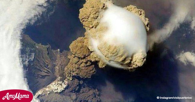
Deadly Volcán de Fuego's eruption could be seen from space
A deadly volcanic eruption in Guatemala could be seen from space, as images from satellites show.
The NASA Earth Observatory released satellite images of Volcan de Fuego vomiting up a plume of ash.
'A deadly mixture of ash, rock fragments, and hot gases rushed down ravines and stream channels on the sides of the volcano,' it stated on its website.
Volcan de Fuego, one of Central America's most active volcanoes, produced an explosive eruption just before noon of June 3, 2018.
It sent ash billowing thousands of meters into the air. Thousands have also been evacuated to minimize the number of casualties.
According to Al Jazeera, at least 110 people have been killed in the aftermath. At least 197 others were also reported missing.
The image shared by NASA Earth Observatory shows the brown ash plume punching through a deck of clouds. The plume's maximum height was estimated to reach 15 kilometers.
The explosion was so massive ash reached several communities surrounding Volcan de Fuego, including Guatemala City, which is 70 kilometers away.
The eruption also sent out harmful gaseous components, including sulfur dioxide.
'The gas can affect human health - irritating the nose and throat when breathed in - and reacts with water vapor to produce acid rain,' warned NASA.
It added that sulfur dioxide can also form aerosol particles when they react in the atmosphere. Aerosols can contribute to outbreaks of haze and sometimes cool the climate.
NASA shared a map showing concentrations of sulfur dioxide in the middle troposphere at an altitude of eight kilometers.
The volcanic eruption led to the closure of La Aurora International Airport.
The earliest eruption of Volcano de Fuego was recorded in 1581. The latest eruption is its most powerful since 1974.
Read more on our Twitter account @amomama_usa.
