Life-Threatening Tornadoes Tear Through 5 U.S. States — Videos
Tornadoes tore across several states on April 2 as powerful storms swept through the United States, with some of the most striking moments caught on camera.
Multiple reports confirmed that tornadoes hit at least five states across the central and eastern U.S. on Wednesday, triggering flash floods, damaging winds, and emergency warnings.
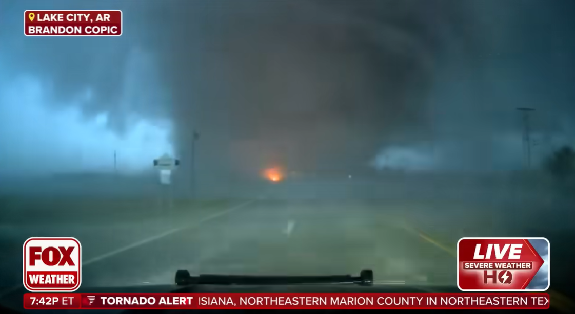
A powerful tornado sweeps through Lake City, Arkansas, as captured in a live broadcast, posted on April 3, 2025 | Source: YouTube/Fox Weather
One of the most intense tornadoes during Wednesday's outbreak struck Lake City, Arkansas, where Fox Weather Exclusive Storm Tracker Brandon Copic captured a massive tornado crossing a road directly in front of his vehicle.
The footage, broadcast live, showed swirling debris, flashing power lines, and street signs bending under extreme winds. A FOX Weather anchor, reacting to the footage in real-time, described the storm as a "monster."
Shortly afterward, Copic encountered another tornado in Caraway, just southeast of Jonesboro. As the storm intensified, he reported live, "This is a strong tornado with the horizontal vortex. This thing is at least an EF 3. This is not weak."
Meanwhile, a FOX Weather broadcaster tracking the same system described it as a "huge wedge tornado on the ground" with horizontal satellites and multiple vortices.
WREG News Channel 3 described the tornado as "incredible" as it tore through Craighead County, where Lake City is located, leaving visible damage.
Lake City Mayor Cameron Tate confirmed to CNN that at least five homes and one power line were down following the tornado. He added that there were no immediate reports of injuries. The Arkansas Division of Emergency Management also confirmed reports of tornadoes on the ground, according to public information officer Lacey Kanipe.
Kanipe said, "We are working with local emergency management offices for situational awareness and still learning of impacts as they come in. It’s early in the event and we will release more information about potential impacts as it becomes available."
The outbreak extended beyond Arkansas. In Oklahoma, a tornado touched down in Owasso, a suburb north of Tulsa. Fox Weather shared a video showing damage to homes and trees after the storm struck early Wednesday morning.
In Indiana, warnings escalated throughout the evening. The National Weather Service (NWS) in Indianapolis issued a tornado warning for Brownsburg, Clermont, and Rocky Ripple.
Minutes later, Indiana's City of Carmel confirmed a tornado on the ground, urging residents to take shelter. In nearby Brownsburg, a warehouse was partially destroyed, highlighting the tornado’s impact on local infrastructure.
In Missouri, Fox Weather shared footage of a tornado in Potosi, warning that severe weather continued to spawn tornadoes throughout the Midwest. Weather.com also confirmed a radar-indicated tornado in the city of Nevada, which caused roof and tree damage.
A tornado was also confirmed near Paxton, Illinois, according to The Weather Channel, adding to the growing list of twisters reported across the Midwest.
Forecasters said storms moving through the mid-Mississippi and Ohio Valleys would likely slow overnight as they encountered a dome of record heat in the Southeast, while new systems were expected to develop over northern Texas. Cities including Dallas, Memphis, Nashville, Louisville, and Cincinnati remained under threat.
The NWS Weather Prediction Center (WPC), in a short-range forecast discussion, warned of a "life-threatening, catastrophic, and potentially historic flash flood event" unfolding across the Lower Ohio Valley and Mid-South.
The risk, they said, would likely persist for several days, fueled by a powerful spring system pulling warm, moist air from the Gulf of Mexico as it moves east.
At the same time, the Storm Prediction Center (SPC) maintained a High Risk warning (Level 5 out of 5) — its highest level — for the same region, where a combination of strong wind shear and instability was expected to produce an outbreak of tornadoes, including multiple intense tornadoes and very large hail.
The system was also expected to support a broad warm sector, generating widespread, intense thunderstorms from the Great Lakes southwest through the Mississippi and Ohio Valleys, the Mid-South, ArkLaTex, and into the Southern Plains.
Additionally, the NWS reported that the storm was bringing a late-season winter system to the Northern Plains and Upper Midwest, with heavy snowfall expected overnight. In the West, unsettled conditions persisted as an upper-level trough moved through the region. Meanwhile, parts of the southern High Plains faced critical fire weather due to dry air and strong winds.
Emergency officials urged the public to stay alert, monitor alerts, and take shelter immediately when conditions worsen.
The April 2 tornadoes came just days after a deadly outbreak swept through the South and Midwest. As reported on March 31, storms that began Friday evening killed at least 18 people and caused widespread damage.
The system intensified on Saturday, hitting parts of Mississippi and Louisiana and prompting a rare Tornado Emergency in Taylorsville, Mississippi.
Days before the event, the SPC issued its highest threat level, warning of possible EF4 or stronger tornadoes. The first twisters touched down in Arkansas and Missouri before the severe weather moved southward.
On Saturday alone, the SPC recorded over a dozen tornado reports, with Mississippi and Alabama bearing the brunt. Mississippi's Walthall County saw at least two powerful tornadoes within 45 minutes.
In Tylertown, three deaths have been confirmed, though officials caution that the toll may rise as rescue teams continue searching through the debris. Initial surveys by the National Weather Service indicate some of the strongest tornadoes reached EF3 strength, with winds up to 165 mph.
Ongoing damage assessments could reveal even stronger tornadoes. As of Saturday afternoon, more than 50,000 customers across Louisiana, Mississippi, and Alabama were without power. The severe weather threat is expected to continue into Sunday, affecting nearly 70 million people from the Northeast to Florida.
An earthquake struck Mississippi, which added to the devastation as the state was still reeling from the powerful tornado outbreak. The seismic event further complicated rescue and recovery efforts, with officials working to assess the full extent of the damage caused by both natural disasters.
However, the severity of destruction depends on multiple factors beyond just the earthquake's magnitude. Variables such as proximity to the epicenter, soil composition, and structural integrity of buildings all play crucial roles.
Generally, significant damage is not expected unless an earthquake registers above a magnitude of 4 or 5, but local conditions can amplify its impact. Authorities are continuing assessments to determine the full extent of the situation.
This earthquake comes amid a string of severe weather events across the country. Four earthquakes struck near Hayward, California, on Thursday, February 13, 2025, according to the U.S. Geological Survey (USGS).
The quakes, ranging from magnitude 2.7 to 3.6, occurred within a small area 2 kilometers east of Hayward at depths between 3.3 and 3.9 miles. The first earthquake of the day, a magnitude 2.7, occurred at 13:03 UTC (5:03 a.m. PST).
Two more quakes struck just two minutes apart, a 3.3 magnitude at 19:52 UTC (11:52 a.m. PST) and a 3.2 magnitude at 19:54 UTC (11:54 a.m. PST). Meanwhile, the USGS reported that the strongest quake, a magnitude 3.6, was recorded at 21:59 UTC (1:59 p.m. PST) at a depth of 3.6 miles.
All four quakes were centered close to each other, with coordinates ranging from 37.645°N to 37.648°N latitude and 122.052°W to 122.059°W longitude. While the earthquakes appeared minor, their location was a stark reminder of the region's seismic vulnerability.
According to the USGS, Hayward sits on the Hayward Fault, a right-lateral, strike-slip fault that runs from San Pablo Bay to Fremont, passing through Berkeley and Oakland.
It moves gradually, creeping at about 5 millimeters (1/5 inch) per year, but some of this movement is uneven. Roughly 4 millimeters (1/6 inch) per year gets stuck, building up stress that eventually releases in earthquakes.
Studies estimate the fault's total movement at 9 millimeters (1/3 inch) per year, combining steady creep with sudden shifts. South of Fremont, it branches into a network of surface faults that connects to the Calaveras Fault. At depths greater than 5 kilometers (3 miles), scientists believe the two faults may merge, potentially influencing seismic activity.
Experts at the University of California, Berkeley Seismology Lab report that the last major earthquake on this fault occurred on October 21, 1868, at 15:53 UTC (7:53 a.m. local time). Known as the 1868 San Francisco earthquake, it struck the Bay Area with an estimated magnitude of 7.0.
The quake ruptured the southern segment of the Hayward Fault, from Berkeley to Fremont, shifting the ground 1.9 meters (6.2 feet) sideways.
The earthquake reportedly caused significant damage. At least five people were killed, and 30 others were injured. Property losses exceeded $300,000, a massive sum at the time.
Seismologists have long studied the recurring pattern of earthquakes along the Hayward Fault. USGS stated major quakes on this fault tend to occur every 140 to 170 years. With over 150 years since the last major rupture, experts warn that the fault is overdue for another powerful earthquake.
The 2003 Working Group for California Earthquake Probability reportedly estimated a 27% probability of a magnitude 6.7 or larger earthquake striking the Hayward-Rodgers Creek Fault system within 30 years. Given this risk, the USGS and other geological agencies continue to monitor seismic activity in the region.
Furthermore, wildfires fueled by intense winds tore through Oklahoma on Friday, March 14. Logan County saw several structures engulfed in flames as firefighters struggled to contain the rapidly spreading blazes.
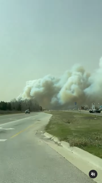
A thick cloud of smoke as a result of the Oklahoma wildfires posted on March 15, 2025 | Source: Instagram/thehotshotwakeup
KOCO 5 Field Meteorologist Michael Armstrong witnessed the devastation firsthand. Reporting from Highway 105 between Henney and Choctaw roads, he described the scene as vehicles and a house burned.
"It's burning to the ground right in front of my eyes," Armstrong said. "There are several vehicles here on fire. Extremely intense wind gusts just blowing Storm Command right now." He called the situation "apocalyptic," as flames consumed everything in their path. "Everything is just incinerated right now around me," he added.
The high winds made firefighting efforts difficult. Videos from the scene showed flames consuming homes and cars while thick smoke filled the air. Emergency crews worked tirelessly to battle the inferno, but the conditions were relentless.
Authorities urged residents to evacuate as the fires moved quickly across dry terrain. The full extent of the damage remains unknown, but officials warned that the threat was far from over.
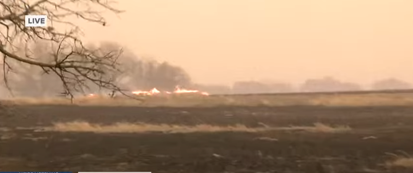
A scene from the Oklahoma wildfires posted on March 15, 2025 | Source: YouTube/@2NewsOklahoma
In Okmulgee County, the Baldhill wildfire was fully contained, while the Gun Club wildfire reached 90% containment. The Stripes wildfire remained at 50%, and the Bever wildfire had an unknown containment status.
Osage County saw multiple wildfires, with varying levels of control. The Acorn wildfire was 75% contained, the Maker wildfire reached 70%, and the Nadel wildfire was at 60%. However, containment levels for the Pulare, Tangon, and Bear wildfires remained unknown.
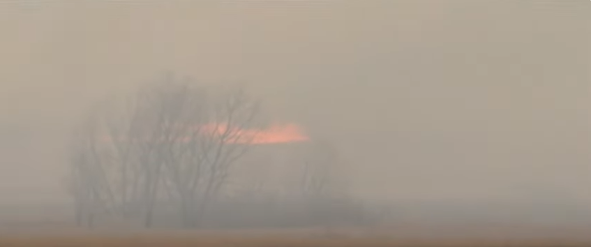
A scene from the Oklahoma wildfires posted on March 15, 2025 | Source: YouTube/@2NewsOklahoma
Other counties, including Oklahoma, Garvin, Seminole, Payne, Creek, Murray, and Pontotoc, reported active fires with no official containment percentages. Authorities urged residents to stay prepared for potential evacuations as conditions continued to evolve.
Emergency officials ordered evacuations in parts of Stillwater on Friday night as a fast-moving wildfire spread into neighborhoods.
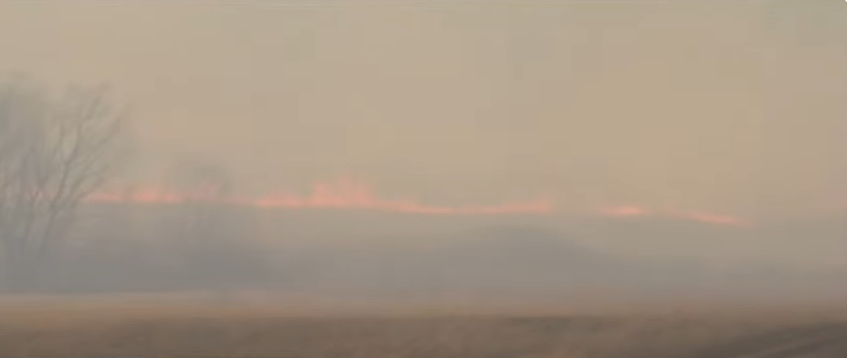
A scene from the Oklahoma wildfires posted on March 15, 2025 | Source: YouTube/@2NewsOklahoma
Rob Hill, director of emergency management, urged residents around Highway 51 and Range Road to evacuate immediately.
"We're asking people to evacuate, the fire has crossed the road into the neighborhoods. We have several structures on fire," Hill said. Hotels and businesses were also impacted. Authorities evacuated the Holiday Inn Express, Hampton Inn, and La Quinta. Walmart was also cleared as a precaution.
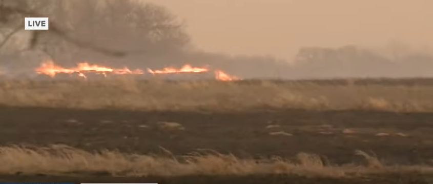
A scene from the Oklahoma wildfires posted on March 15, 2025 | Source: YouTube/@2NewsOklahoma
Meanwhile, strong winds worsened conditions across the region. In a post on X, the National Weather Service in Norman reported a massive dust storm sweeping through Oklahoma. The agency warned that visibility was at its lowest in northwest Oklahoma, where dust was being pulled into the storm from the north.
Dewey and Custer counties became the latest areas impacted by Oklahoma's raging wildfires. Late Friday night, the NWS issued a fire warning for northeastern Roger Mills County, western Dewey County, and northwestern Custer County at the request of Oklahoma Forestry Services.
Officials reported that at 9:13 p.m. CDT, a dangerous wildfire was located four miles northeast of Leedey and moving east at 1 to 3 mph. The fire threatened Camargo, Leedey, Angora, and surrounding areas.
Authorities urged residents to prepare for possible evacuations and follow all safety instructions. They warned against driving into smoke and emphasized the potential for extreme fire behavior, including wind-driven flames and torching trees.
Firefighters remained on high alert as shifting winds and dry conditions continued to fuel the blazes. Emergency crews monitored the situation closely, ready to respond as the fire advanced.
