
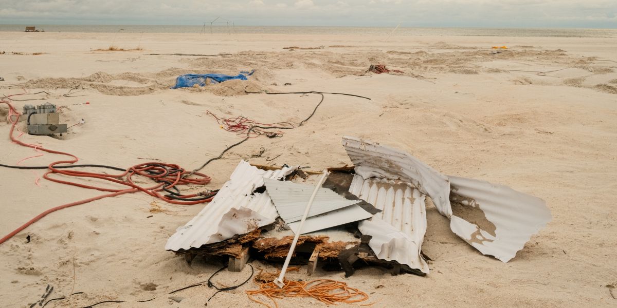
Debris and damaged equipment scattered across a coastal area | Source: Getty Images
Here's What to Know About Tropical Depression Chantal
Even as the storm loses strength, forecasters and emergency officials are urging residents not to let their guard down — key updates and safety steps remain in effect.
Advertisement
Chantal made landfall early Sunday as a tropical storm between Charleston, South Carolina, and Wilmington, North Carolina. It was downgraded to a tropical depression shortly afterward, according to the National Hurricane Center (NHC) and the Weather Prediction Center (WPC).
The system continues to bring dangerous conditions to parts of the U.S. Southeast as it moves inland. As of 5 p.m. EDT, Chantal was located about 65 miles south-southwest of Raleigh, North Carolina, with sustained winds of 30 mph. It is moving north-northeast at 10 mph and is expected to accelerate toward the northeast through Monday.
Advertisement

Waves crash along the pier at Wrightsville Beach, North Carolina, as Tropical Storm Chantal makes landfall, posted on July 7, 2025 | Source: YouTube/ABC News
A tropical storm warning remains in effect for coastal areas from the South Santee River, South Carolina, to Surf City, North Carolina, where conditions remain unstable. Earlier in the day, wind gusts reached 50 mph, with sustained winds of 45 mph reported at Apache Pier in South Carolina.
Advertisement
Inland, flash flood watches have been issued for central North Carolina and south-central Virginia, where 2 to 4 inches of rain are expected, with isolated areas seeing up to 6 inches. These amounts may lead to localized flooding, particularly in urban and low-lying areas.
Advertisement
A tornado watch is also active for eastern North Carolina, where isolated tornadoes remain possible as the storm's rainbands move across the region.
Along the coastline, life-threatening surf and rip current conditions are expected to continue from northeastern Florida to the Mid-Atlantic states, prompting ongoing advisories for beachgoers and coastal residents.
Forecasters continue to track Chantal's inland progression and advise residents in affected areas to monitor official updates and follow local emergency guidance.
Advertisement
Officials also urge residents to prepare for potential evacuations and extended emergency conditions. Ready, the official emergency preparedness website of the U.S. Department of Homeland Security, encourages individuals to first understand the specific risks facing their community.
Local hazards can vary widely — from hurricanes and floods to wildfires or power outages — so residents are encouraged to use the Federal Emergency Management Agency (FEMA) National Risk Index to understand the most likely threats in their area.
Advertisement
A key part of disaster readiness is having a clear evacuation plan in place before an emergency strikes. This includes selecting multiple safe destinations — such as public shelters, hotels, or the homes of friends or relatives — and identifying primary and alternate evacuation routes through local emergency management agencies. Pet owners should also plan ahead, as most shelters allow only service animals.
Advertisement
Equally critical is assembling a disaster supplies kit, also known as a "go-bag." This pack should include at least one gallon of water per person per day, a several-day supply of non-perishable food, a flashlight, a weather radio (battery-powered or hand-crank), extra batteries, a first aid kit, and hygiene products.
Advertisement
Additional essential items include prescription medications, a phone charger and backup battery, important documents, cash, face masks, a manual can opener, and supplies for infants, seniors, or pets if applicable. These items should be packed in sturdy, easy-to-carry containers and stored in a location known to everyone in the household.
Ready also recommends maintaining separate kits at home, at work, and in your car to ensure access wherever you are when disaster hits.
Advertisement
Before evacuating, residents should prepare their vehicles by filling up gas tanks in advance, since stations may close or lose power during emergencies. Homeowners are advised to secure windows and doors, unplug appliances, and shut off utilities only if instructed.
If evacuation orders are issued, leaving early is advised to avoid being trapped by flooding or road congestion. Those without access to transportation should coordinate with local officials or neighbors ahead of time.
Advertisement
During an evacuation, Ready advises taking the go-bag, securing the home, and following only designated routes — avoiding shortcuts, which may be blocked. Staying informed is critical: the FEMA App, available for smartphones, provides real-time alerts, open shelter locations, and hazard updates.
Officials also recommend listening to a battery-powered radio for emergency instructions. If time permits, residents should inform an out-of-state contact of their destination and leave a note at home for others.
Advertisement
After evacuation, especially for those who left ahead of the storm, residents are advised to return home only when local officials confirm it is safe. According to federal preparedness guidance, power outages, service disruptions, and hazardous conditions — such as downed power lines or storm debris — may still pose risks in affected areas.
Emergency preparedness officials emphasize that planning ahead not only increases safety but also reduces chaos during a crisis.
Advertisement
While current updates focus on staying prepared, storms earlier this year showed how quickly severe weather can turn dangerous. Just two months ago, tornadoes swept through several states, leaving behind widespread damage and dramatic scenes captured on video.
Multiple reports confirmed that tornadoes hit at least five states across the central and eastern U.S. on Wednesday, April 2, triggering flash floods, damaging winds, and emergency warnings.

A powerful tornado sweeps through Lake City, Arkansas, as captured in a live broadcast, posted on April 3, 2025 | Source: YouTube/Fox Weather
One of the most intense tornadoes during Wednesday's outbreak struck Lake City, Arkansas, where Fox Weather Exclusive Storm Tracker Brandon Copic captured a massive tornado crossing a road directly in front of his vehicle.
Advertisement
The footage, broadcast live, showed swirling debris, flashing power lines, and street signs bending under extreme winds. A FOX Weather anchor, reacting to the footage in real-time, described the storm as a "monster."
Shortly afterward, Copic encountered another tornado in Caraway, just southeast of Jonesboro. As the storm intensified, he reported live, "This is a strong tornado with the horizontal vortex. This thing is at least an EF 3. This is not weak."
Meanwhile, a FOX Weather broadcaster tracking the same system described it as a "huge wedge tornado on the ground" with horizontal satellites and multiple vortices.
Advertisement
WREG News Channel 3 described the tornado as "incredible" as it tore through Craighead County, where Lake City is located, leaving visible damage.
Lake City Mayor Cameron Tate confirmed to CNN that at least five homes and one power line were down following the tornado. He added that there were no immediate reports of injuries. The Arkansas Division of Emergency Management also confirmed reports of tornadoes on the ground, according to public information officer Lacey Kanipe.
Advertisement
Kanipe said, "We are working with local emergency management offices for situational awareness and still learning of impacts as they come in. It’s early in the event and we will release more information about potential impacts as it becomes available."
The outbreak extended beyond Arkansas. In Oklahoma, a tornado touched down in Owasso, a suburb north of Tulsa. Fox Weather shared a video showing damage to homes and trees after the storm struck early Wednesday morning.
Advertisement
In Indiana, warnings escalated throughout the evening. The National Weather Service (NWS) in Indianapolis issued a tornado warning for Brownsburg, Clermont, and Rocky Ripple.
Minutes later, Indiana's City of Carmel confirmed a tornado on the ground, urging residents to take shelter. In nearby Brownsburg, a warehouse was partially destroyed, highlighting the tornado’s impact on local infrastructure.
Advertisement
In Missouri, Fox Weather shared footage of a tornado in Potosi, warning that severe weather continued to spawn tornadoes throughout the Midwest. Weather.com also confirmed a radar-indicated tornado in the city of Nevada, which caused roof and tree damage.
Advertisement

Advertisement
A tornado was also confirmed near Paxton, Illinois, according to The Weather Channel, adding to the growing list of twisters reported across the Midwest.
Forecasters said storms moving through the mid-Mississippi and Ohio Valleys would likely slow overnight as they encountered a dome of record heat in the Southeast, while new systems were expected to develop over northern Texas. Cities including Dallas, Memphis, Nashville, Louisville, and Cincinnati remained under threat.
Advertisement
The NWS Weather Prediction Center (WPC), in a short-range forecast discussion, warned of a "life-threatening, catastrophic, and potentially historic flash flood event" unfolding across the Lower Ohio Valley and Mid-South.
The risk, they said, would likely persist for several days, fueled by a powerful spring system pulling warm, moist air from the Gulf of Mexico as it moves east.
At the same time, the Storm Prediction Center (SPC) maintained a High Risk warning (Level 5 out of 5) — its highest level — for the same region, where a combination of strong wind shear and instability was expected to produce an outbreak of tornadoes, including multiple intense tornadoes and very large hail.
Advertisement
The system was also expected to support a broad warm sector, generating widespread, intense thunderstorms from the Great Lakes southwest through the Mississippi and Ohio Valleys, the Mid-South, ArkLaTex, and into the Southern Plains.
Advertisement
Additionally, the NWS reported that the storm was bringing a late-season winter system to the Northern Plains and Upper Midwest, with heavy snowfall expected overnight. In the West, unsettled conditions persisted as an upper-level trough moved through the region. Meanwhile, parts of the southern High Plains faced critical fire weather due to dry air and strong winds.
Emergency officials urged the public to stay alert, monitor alerts, and take shelter immediately when conditions worsen.
Advertisement
Advertisement